
Lakewood ZIP Code Coverage
Official Lakewood material repeatedly identifies 90712, 90713, and 90715 as the city’s working ZIP codes. The ranges are useful because they group addresses for delivery and city services, but each one also touches broader postal geography. The ZIP code directory therefore begins with a coverage table and ends with a parcel or boundary check.
| ZIP | Areas and anchors | Post-office context | Research note |
|---|---|---|---|
| 90712 | Central and west-central Lakewood, Civic Center, Iacoboni area, portions toward Lakewood Center | Lakewood postal name or station; verify exact delivery route in USPS | City Hall uses 90712; postal reach is not the legal line |
| 90713 | Southern and eastern-central residential Lakewood, including Woodruff and Carson-side areas | Lakewood postal name | City documents recognize 90713 residents, but postal name needs a parcel check |
| 90715 | Far eastern Lakewood, Palms Park, and Imperial Estates vicinity near 605 | Lakewood postal name; verify the exact station in USPS | City assistance routes this area to Palms Park and interfaces with neighboring postal geography |
No official source in the research identifies a Lakewood PO-box-only or unique ZIP, a ZIP split, or a realignment year. Do not fill that gap with a national ZIP summary that lacks a city boundary statement.
Lakewood Postal Names and City Lines
USPS “Cities by ZIP” labels describe preferred or acceptable mailing names. They do not certify incorporation. A Lakewood mailing address can fall outside the municipal boundary, and an address near the edge can use a neighboring postal label. The USPS address-to-ZIP lookup is the authoritative deliverability check for a specific address.
After USPS, compare the normalized assessor situs, Lakewood boundary or council map, and city service result. This matters in Carson Park, where much of the area south of Carson Street joined Long Beach in 1953 while the northern part entered Lakewood in 1954. A postal label, census place, library catalog term, and city jurisdiction can all differ while still pointing to the same regional history.
The Lakewood ZIP code directory can narrow the question, but the Lakewood maps collection and parcel record settle the place question more reliably than the mailing city alone.
Lakewood 90712 ZIP Context
90712 is associated with central and west-central Lakewood, the Civic Center, the Iacoboni area, and portions toward Lakewood Center. City Hall uses 90712, which makes the code a useful starting point for municipal correspondence and local-history searches. It still does not create a ZIP-wide resident list.
For an address in 90712, use USPS to confirm delivery, the Assessor Portal to obtain the AIN and situs, and Lakewood’s In My Neighborhood tool for council, school, park, project, and service information. A directory or permit result tied to 90712 should preserve its source label. “Lakewood” in a library catalog may identify a local-history topic, while the assessor’s situs identifies a parcel.
These checks keep the 90712 part of the Lakewood ZIP code directory useful without confusing a postal route with ownership or household membership.
Lakewood 90713 ZIP Edge
90713 covers southern and eastern-central residential parts of Lakewood, including Woodruff and Carson-side areas in the research description. The code can help group a set of addresses for a local-history or service question. It cannot tell which residents are registered, which homes share a parcel, or where a person moved.
Use the city’s service tool to check whether an address receives the relevant Lakewood route, then use the assessor situs and map. For a person question, the voter-status form requires last name, birthdate, house number, and ZIP Code, so 90713 is only one part of a self-verification. A qualified voter-file request is a separate statutory route and is not a casual ZIP browse.
When 90713 appears in a historical source, pair it with street, tract, school, newspaper title, or legal description. That second clue is especially important for older records that use county or Long Beach-area labels.
Lakewood 90715 ZIP Edge
90715 serves far eastern Lakewood, including the Palms Park and Imperial Estates vicinity near the 605. City assistance routes 90715 residents to Palms Park. The edge touches Cerritos and Hawaiian Gardens postal geography, so the code is a strong prompt to check the exact parcel rather than a final jurisdiction answer.
Development dates add a useful historical test. Imperial Estates dates from 1958-62, while Lakewood Manor dates from 1962-63. A directory, deed, or permit that uses one of those tract names can be more precise than a ZIP. The Lakewood Story supplies the neighborhood history; the assessor and city map confirm the modern location.
A 90715 address can therefore belong to a Lakewood history trail even when a postal search result points toward a neighboring city. Keep the ZIP, tract, and municipal boundary as separate facts.
Lakewood ZIP Search Paths
The public tools do not provide a ZIP-wide Lakewood residents directory. The assessor landing page accepts address or AIN and returns ZIP as part of a normalized situs result, but its inspected interface does not advertise ZIP-only bulk filtering. The voter status form accepts ZIP only alongside three identity fields. City service tools use the address to route districts and services.
- Verify the exact address and ZIP with USPS.
- Search the Assessor Portal by address or AIN and save the situs, parcel, and map clues.
- Use Lakewood Maps or In My Neighborhood to check city service and boundary context.
- For your own voter record, enter last name, birthdate, house number, and ZIP in the LA County form.
- Once the ZIP narrows the geography, move to the Lakewood street directory for parcel-by-parcel work.
The order matters. A ZIP is a filter for geography. An AIN or legal description is the parcel key. A person’s name still needs an independent identity anchor.
The fallback chain is important when the address tool does not answer the question. USPS confirms delivery, the assessor confirms parcel context, Lakewood Maps confirms civic geography, and the city’s records process can answer a municipal question by address or date range. The county recorder still needs a party name and recording year, while a historical directory needs a title and edition. No one of those channels can enumerate a ZIP by itself.
For family history, save the ZIP as a clue beside the street, tract, school, newspaper, or legal description. For a current person check, use two identity anchors and record the source label. A ZIP that appears in a directory or obituary can be a postal label, not proof of incorporation.
Lakewood Assessor Situs ZIP
The Assessor Portal is the most useful bridge between a ZIP code directory and a specific parcel. Its address result can show AIN, situs address, city and ZIP, use type, parcel status, tax-rate area, exemption indicator, units, building facts, year-built fields, roll values, map, and map index. “Situs” means the physical parcel, while a mailing address routes correspondence and may differ.
| Search by AIN or Address | Required text or autocomplete; enter exact address or a hyphenated AIN |
|---|---|
| Basic Search | Address or AIN starting mode |
| Legal Search | Legal-description mode for tract and lot context |
| Map Search | Pan, zoom, and parcel selection for adjacent geography |
| ZIP result | Part of the normalized situs result, not a ZIP-only resident list |
Use the LA County Assessor Portal to tie 90712, 90713, or 90715 to an address. Do not infer that the person named in an owner context is every person at the parcel.
Note: The assessor’s ZIP is parcel context, while USPS’s ZIP is delivery context; preserve both labels in a research log.
Lakewood Voter ZIP Limits
ZIP appears in the LA County voter-status form because it helps match one voter to a registration record. It is not a public browse key. The form asks for last name, birthdate, house number, and ZIP Code. California Elections Code §§2188 and 2194 restrict broader voter-file use to approved election, scholarly, journalistic, political, or governmental purposes, with purpose, security, and distribution controls.
| Voter field | Required | Meaning |
|---|---|---|
| Last Name | Yes | Alphabetic identity field |
| Birthdate | Yes | mm/dd/yyyy match field |
| House Number | Yes | Numbers-only residence field |
| Zip Code | Yes | Numbers-only location match |
Approved files can include residence and mailing addresses, precinct, party preference, registration date, status, participation date and method, and district links. Driver-license or ID numbers, partial Social Security numbers, unique identifiers, and signatures are excluded. A ZIP-sorted file is not available for casual curiosity.
The research lists a $100 statewide voter file, specific-person requests up to ten at $30 each with a $100 cap, and a county-specific route through the county. Active status is the default; inactive voters, history, and district fields must be requested. The applicant certifies the statutory purpose and data-security controls before any file is released.
Use the LA County voter status tool for a self-check and the California voter-access rules before treating any approved file as a research source.
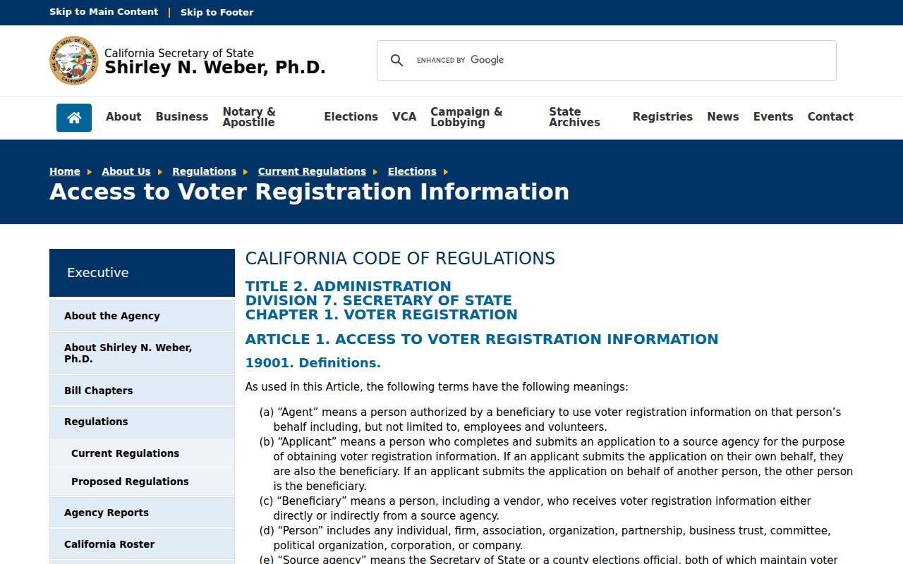
The voter-access rule set makes the ZIP distinction concrete: an approved file has a certified purpose and defined fields, while a ZIP-wide resident list is not a casual public result.
Lakewood ZIP Code and ZCTA
A ZIP Code is a postal delivery construct. A ZIP+4 adds a delivery segment. A carrier route is a delivery path. A ZIP Code Tabulation Area, or ZCTA, is a Census approximation built for statistical tables, not a postal promise or municipal boundary. The terms can sit beside one another in a data set while describing different geographies.
Lakewood’s compact postwar lots and edge-city history make the distinction practical. Carson Park crosses a historic city line. Postal ZIPs touch neighboring cities. City service tools recognize 90712, 90713, and 90715 for particular routes. A Census table can aggregate a ZCTA even when its edge does not match the Lakewood line. Verify a person or parcel with the exact address, assessor situs, and city map.
Boundary rule. A ZIP narrows geography, not identity. The Lakewood ZIP code directory should lead to an address and parcel check before any resident conclusion.
The research found no official Lakewood ZIP-wide resident list, unique or PO-box-only ZIP, or documented split year. That absence is a result, not a reason to substitute a private compilation.